

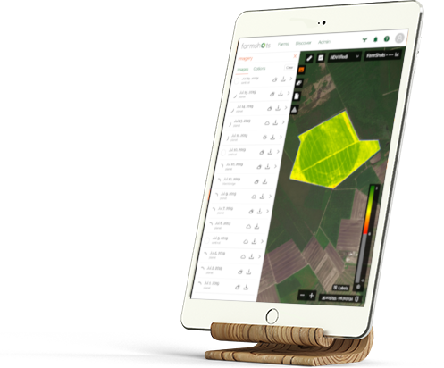

FarmShots™ satellite imagery service provider is a solution to help growers maximize yield, efficiency and profits. As an expert in high resolution satellite imagery analysis, FarmShots will analyze satellite and drone imagery to help detect diseases, pests and poor plant nutrition. The software integrates seamlessly into the AgriEdge whole-farm management program; which allows growers to make better, faster decisions. Satellite imagery allows growers to pick out problem areas on their farm, keep track of the locations of issues, share information about changes to a field and set up agronomists, suppliers, and farmers in a hierarchy.
Full details provided and a very useful youtube video https://youtu.be/VKeMZqmZMEQ
https://www.farmprogress.com/crops/imagery-service-evolves-crop-protection-company
Images become available 24 hours after they are acquired.
Full details are provided and there is a very useful youtube video https://youtu.be/VKeMZqmZMEQ. You can sign up for a demonstration.
FarmShots is available to use on multiple devices including tablets, laptops and smart phones in an easy to use the web-based app.
Precise locations identified. Can track crop walking in fields.